Android tablet beta
Sign up with the Google account on your tablet. Your Play tester invite will arrive within 24 hours.
INFOMAR Survey Data
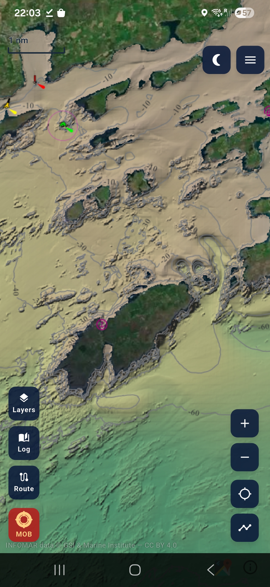
INFOMAR is the most detailed seabed survey of Ireland ever made — twenty years of sonar data from the Geological Survey and Marine Institute. Depth. Ground type. Contour lines down to the metre. It's the best marine data available for these waters, and Maranox puts it on the mounted screen you use at sea.
Colour-coded depth and contour lines around the full Irish coast. The kind of detail a yacht skipper uses to avoid a bar and an angler uses to find a drop-off — same data, both jobs.
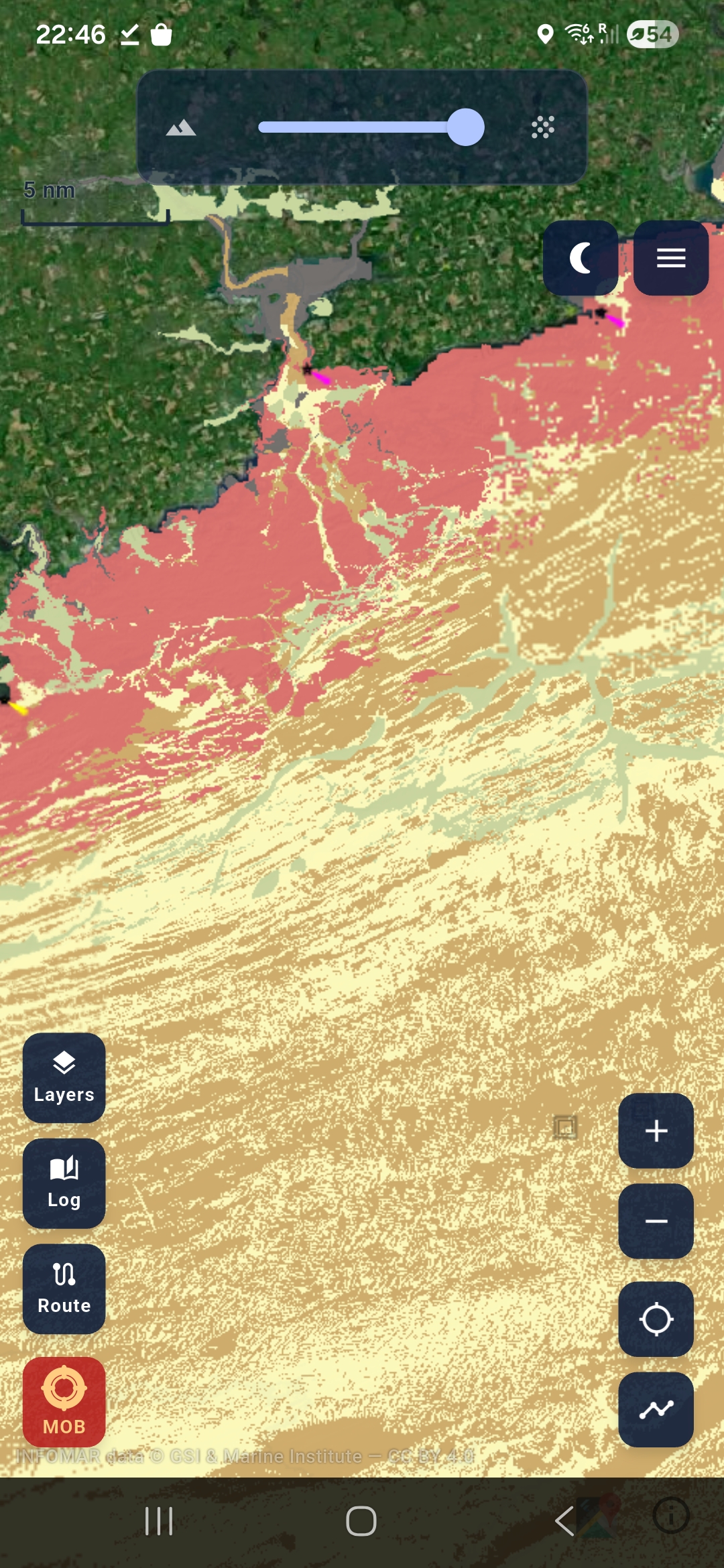
Not just how deep — what the bottom is made of. Mud, sand, gravel, rock, or mixed. Matters whether you're shooting gear, anchoring for the night, planning a dive, or picking a wreck. And it's already on the chart for the whole Irish coast — no sounder, no surveying, not just where you've already been.
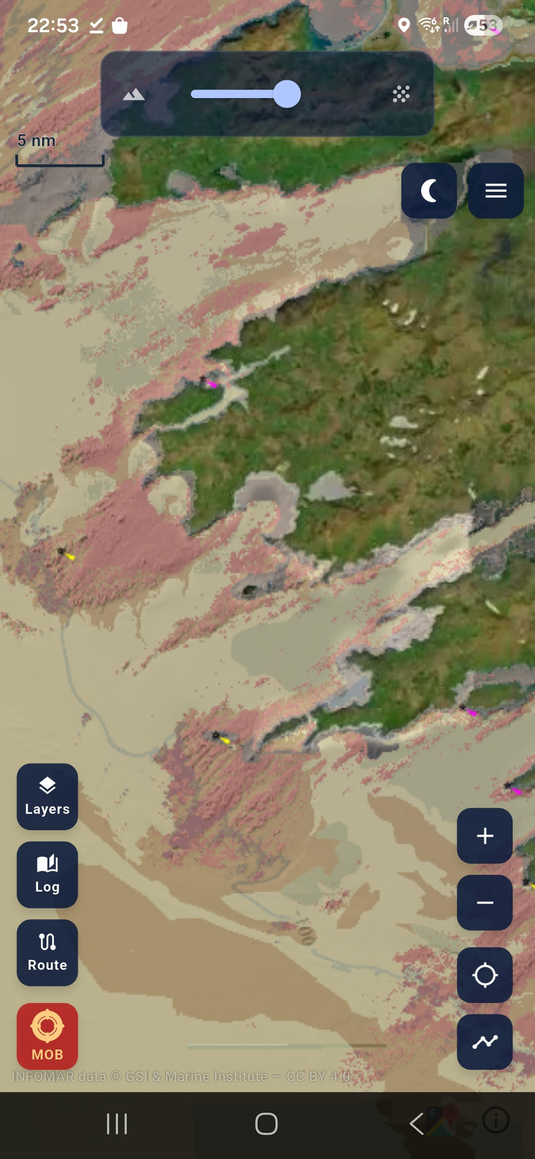
Slide between sediment colours and depth contours. See where sand meets rock, where the ground drops off, where the good tows are. All in one view.
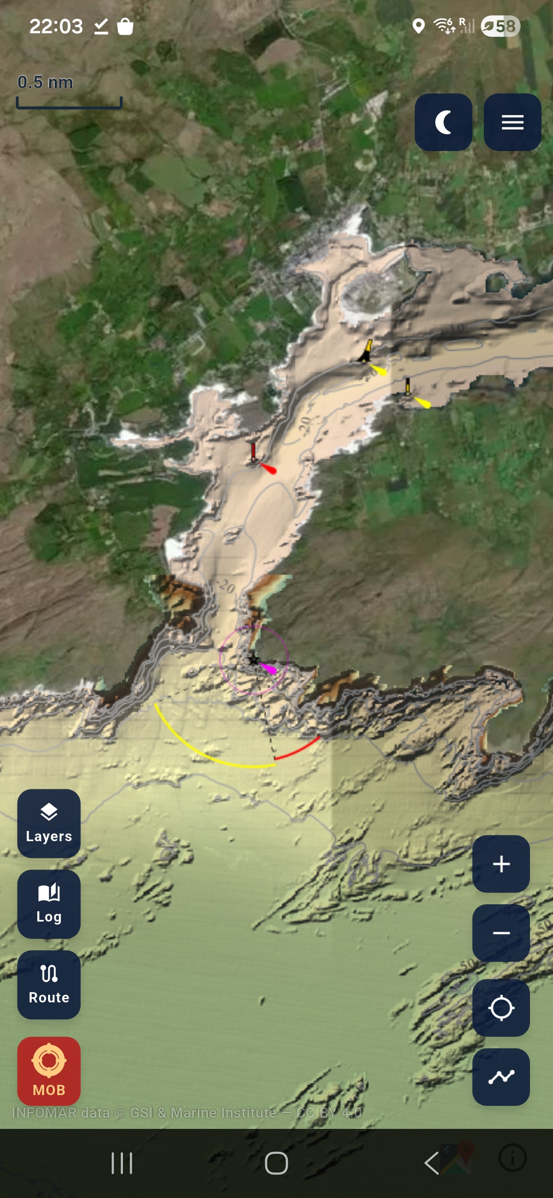
Download the charts once on Wi-Fi. At sea, everything loads from your phone — no internet, no buffering, no signal needed. Mount a tablet in the wheelhouse and you've got a chart plotter.
Shipwrecks & Diving
Geological Survey Ireland catalogued every known wreck in Irish waters. Maranox puts them all on the chart — with the seabed data a dive skipper actually needs to plan the dive.
Wreck position over INFOMAR bathymetry — see the depth, the contours around it, and the terrain the wreck sits on.
Rock, sand, mud or mixed — the sediment layer shows what's around the wreck so you know what visibility and conditions to expect.
Drop marks on your favourite spots — reefs, walls, scenic dives, drift routes. Saved on your phone, always there.
All 608 wrecks are bundled in the app. Seabed charts download once. Works 50 miles offshore.
Maranox Tablet
Join the Android tablet beta with the Google account on your tablet, or email us about iPad access.
Sign up with the Google account on your tablet. Your Play tester invite will arrive within 24 hours.
iPad access is being lined up for the Apple release. Email us and we will let you know the right next step.
Ask about iPadBy signing up you agree to be contacted about Maranox tablet access. Your email is deleted once you're added as a tester or whenever you ask. See our privacy policy.