INFOMAR Map App
The Irish seabed survey, usable on your phone.
Maranox turns INFOMAR data into offline Android charts for Irish waters, with seabed depth, ground type, wrecks, GPS marks, tracks and routes in one app.
Why INFOMAR Matters
Depth is only half the story.
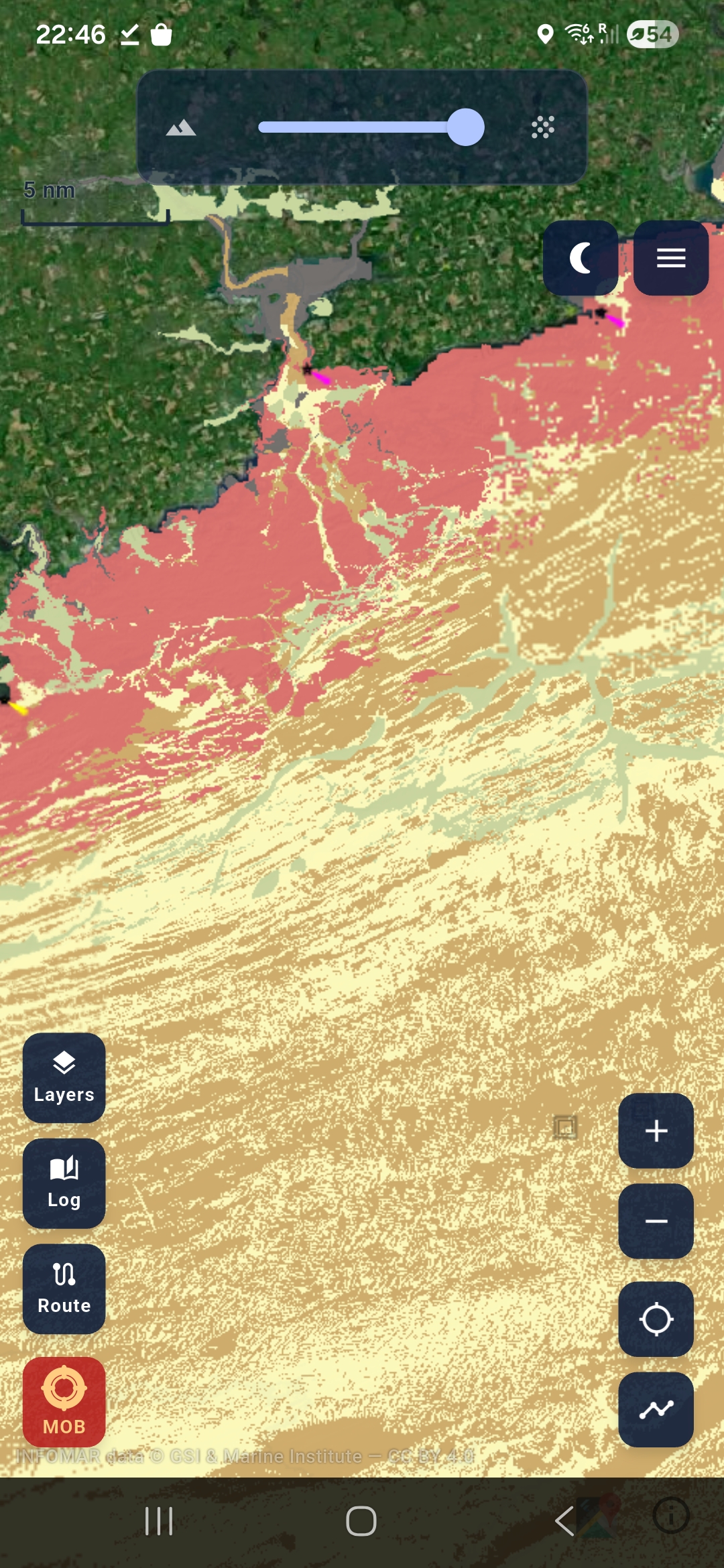
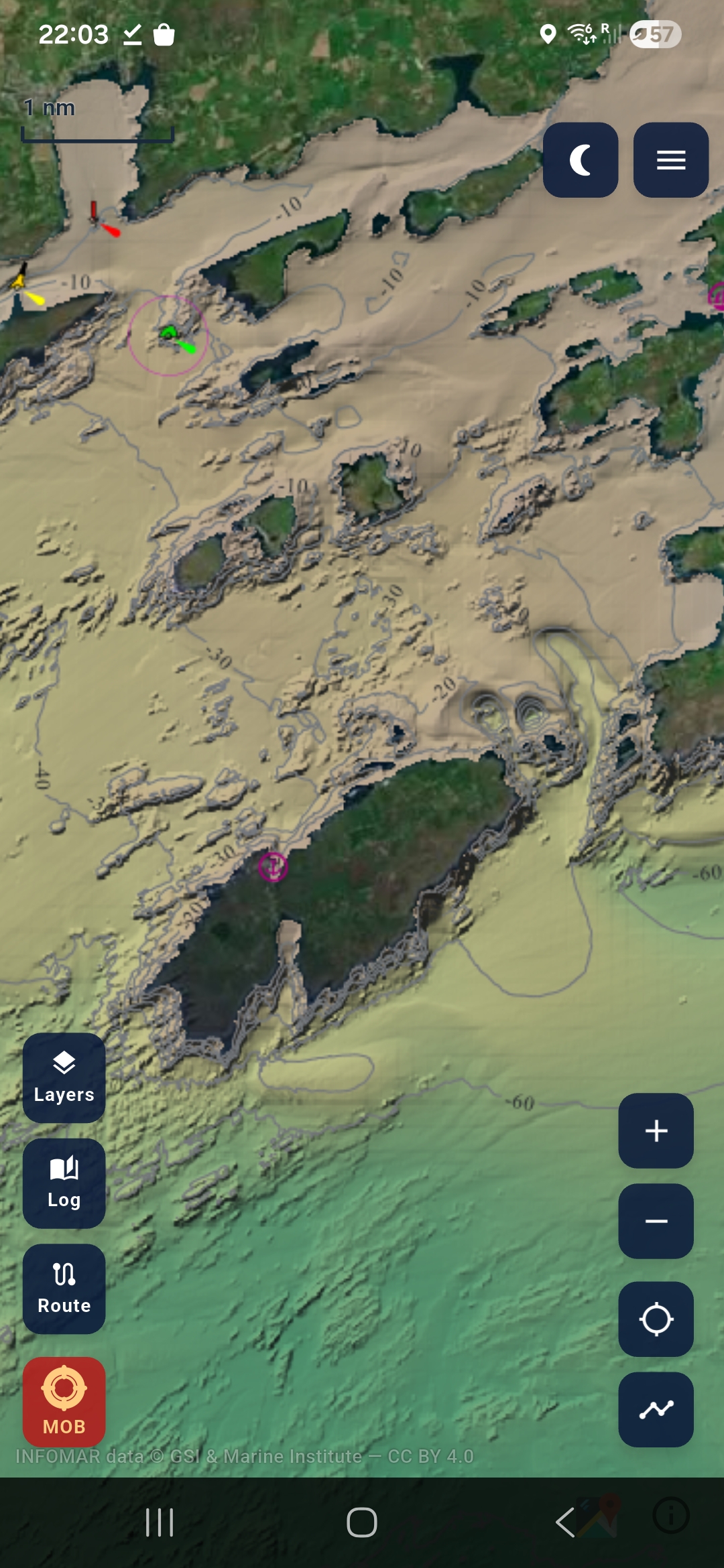
INFOMAR maps the shape and makeup of the seabed around Ireland. For boaters that means depth contours. For anglers it means rock, sand, mud and mixed ground. For divers it means wrecks with surrounding seabed context. Maranox brings those layers together in a phone chart that can be downloaded before you go afloat.
What you can do in Maranox.
- Read bathymetry and contour lines around the Irish coast.
- Switch on ground type to see rock, coarse, mixed, sand and mud.
- Tap shipwrecks and view them in seabed context.
- Save your own marks and record tracks over the chart.
- Download chart packs on Wi-Fi and use them at sea without signal.
Maranox is for planning and situational awareness. It is not a certified navigation system or a replacement for official charts, VHF radio, safety gear or proper seamanship.