Desktop access
For Windows, Linux or Mac wheelhouse setups, email us with your vessel and computer setup.
Ask about desktop accessMaranox Desktop
Large chart view, offline Irish seabed data, fishing marks and sediment layers with room to work.
Sediment for fishermen
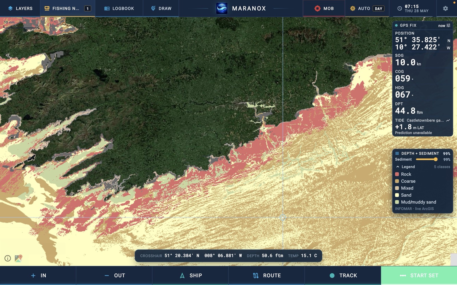
Depth tells you where the water is. Sediment tells you what you are working over: rock, coarse ground, mixed bottom, clean sand, mud or muddy sand. And it's already on the chart for the whole Irish coast — no sounder, no surveying, not just the patches you've already worked.
INFOMAR Survey Data
INFOMAR is the most detailed seabed survey of Ireland ever made — twenty years of sonar data from the Geological Survey and Marine Institute. Depth. Ground type. Contour lines down to the metre. It's the best marine data available for these waters, and Maranox puts the whole thing on the wheelhouse screen.
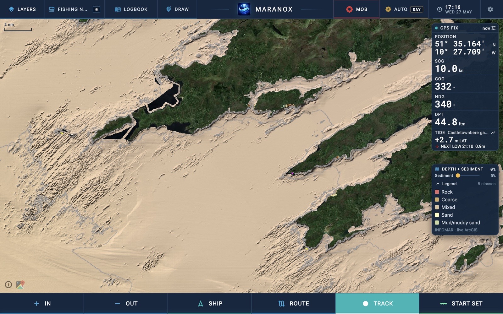
Colour-coded depth and contour lines around the full Irish coast. Readable from the helm, with coastline, depth, cursor position and vessel data in one working view.
Not just how deep — what the bottom is made of. Mud, sand, gravel, rock, or mixed. Matters whether you're shooting gear, anchoring for the night, planning a dive, or picking a wreck.
Download the charts once on Wi-Fi. At sea, everything loads from the wheelhouse computer — no internet, no buffering, no signal needed.
Plotting & Marks
Everything you reach for at the helm — routes, marks, tracks and a man-overboard button — built for a mouse, a keyboard and a big screen.
Quick ship-to-cursor legs or multi-waypoint passages, with live distance and time-to-go worked out from your own speed.
Save grounds, hazards, anchorages and dive sites with names, categories and notes. Set a gear timer and watch the soak.
Lay a breadcrumb trail as you steam, saved to the wheelhouse computer with the time it was made.
One press freezes the position and starts the elapsed-time count, so the whole crew knows where to look.
Mark lines, areas and notes straight on the chart, and measure distance and bearing between any two points.
Step back through any day's tracks and marks on the chart. See where you worked and how it fished.
Live Data & Overlays
Live conditions and the official Irish boundaries, layered over the same seabed chart. Toggle on what you need, leave the rest off.
Live water level from 21 tide gauges, plus wave height, wind and sea temperature from 19 buoys around the coast (Marine Institute).
Modelled current arrows so you can see which way the water is setting before you shoot gear or steam.
83 Irish lighthouses and 43 RNLI lifeboat stations, tap any one for detail.
The 12-mile limit, protected and fishery areas and the Nephrops Functional Units, drawn straight on the chart.
The 6-mile inshore zone and EU boxes for reference. Advisory only — always check the official notice.
EMODnet vessel density, bottom-trawl intensity and shipping-route density, to see where the traffic and effort goes.
Shipwrecks & Diving
Geological Survey Ireland catalogued every known wreck in Irish waters. Maranox puts them all on the chart — with the seabed data a dive skipper actually needs to plan the dive.
Wreck position over INFOMAR bathymetry — see the depth, the contours around it, and the terrain the wreck sits on.
Rock, sand, mud or mixed — the sediment layer shows what's around the wreck so you know what visibility and conditions to expect.
Drop marks on your favourite spots — reefs, walls, scenic dives, drift routes. Saved in Maranox, always there.
All 608 wrecks are bundled in the app. Seabed charts download once. Works 50 miles offshore.
Built for the Wheelhouse
A few things that matter on a working boat.
Desktop access
Desktop access is handled directly while the wheelhouse build is being tested. Email us with your vessel and computer setup and we will help you get the right build.
For Windows, Linux or Mac wheelhouse setups, email us with your vessel and computer setup.
Ask about desktop accessBy emailing us you agree to be contacted about Maranox Desktop access. Your email is deleted once you're set up on desktop, or whenever you ask. See our privacy policy.